Every photo
has a place.
Go find it.
Photer is the geo-tagged photo discovery app. Every shot on Photer is pinned to the exact spot it was taken — so you can explore the world through real photos, scout stunning locations before you travel, and put your own favorite places on the map.
Your geo-photographic memory.
Most photo apps tell you what a place looks like. Photer tells you exactly where to stand. Every photo is anchored to real GPS coordinates and organized on an interactive world map, so browsing photos becomes exploring places.
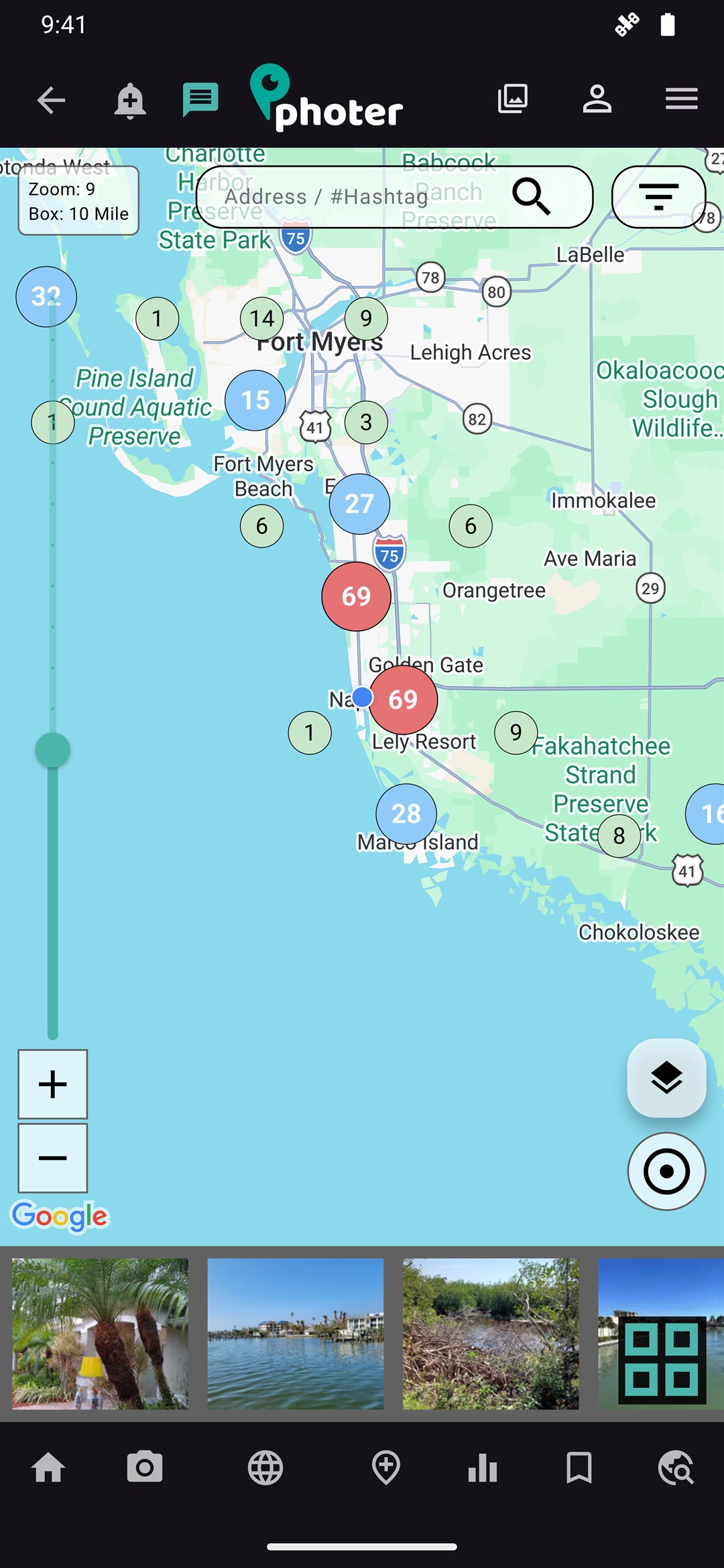
Zoom into any city and Photer divides the area into a smart grid, showing you at a glance how many photos live in each square — from a quiet fishing pier with one perfect sunset shot to a downtown block with hundreds. Tap a cluster, swipe through the shots taken right there, and save the spots you want to visit.
- Real locations, real photosNo stock imagery — every pin is a photo someone actually took there.
- Search by address or #hashtagJump straight to a street corner, a city, or a community tag like #visitmke.
- Total recall, on demandFilter your own shots by place or category and land straight back on the moment you're chasing.
- Built for discoveryRestaurants, trails, beaches, murals, stadiums — if it's photogenic, it's on the map.
- Photos with coordinates, not just captionsEvery shot carries the GPS data that placed it, so the location is the point — never an afterthought.

Designed for the way explorers actually browse.
A fast, dark, photo-first interface — straight from the live app.
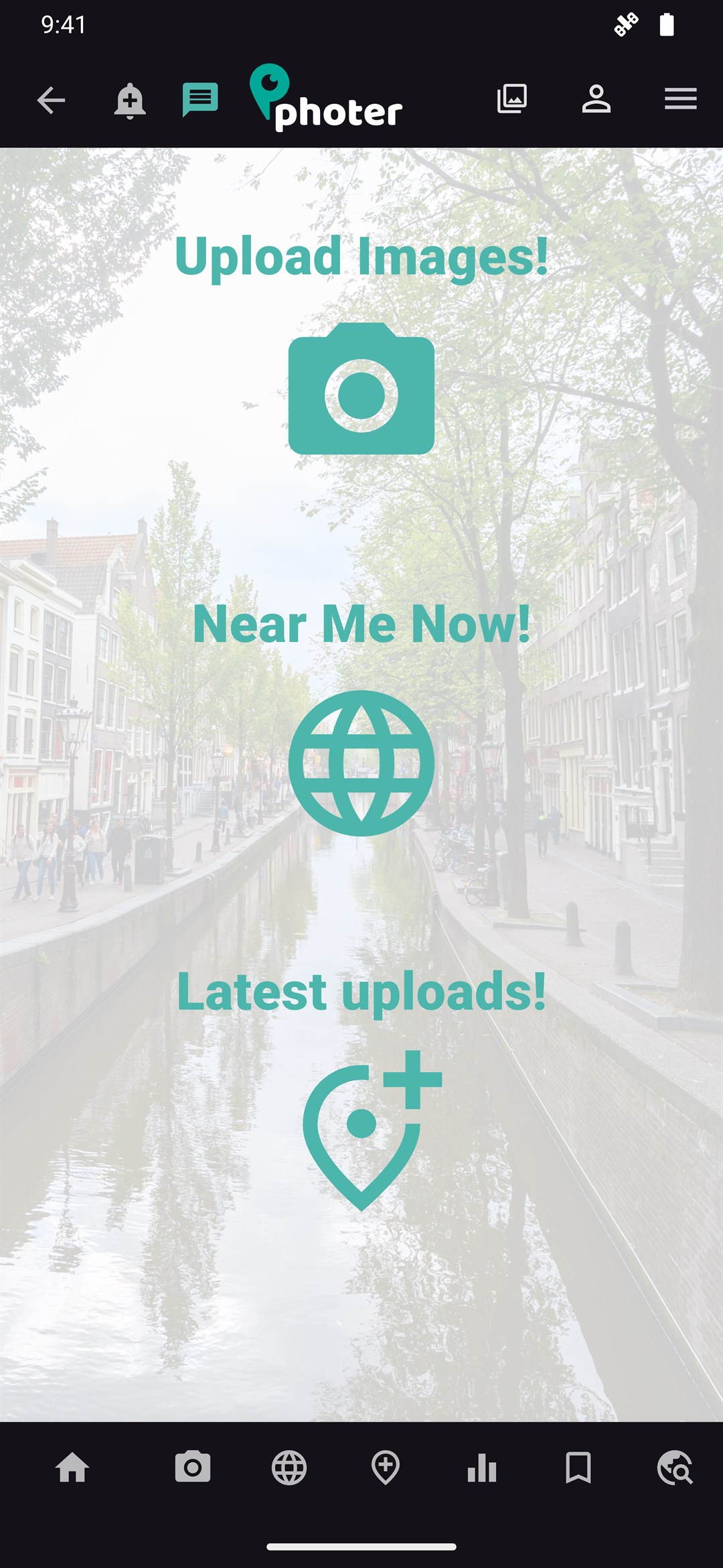
Home
Three taps to everything: upload a shot, see what's near you, browse the newest pins.
Map
The signature grid map — photo counts per square, live search, filters.
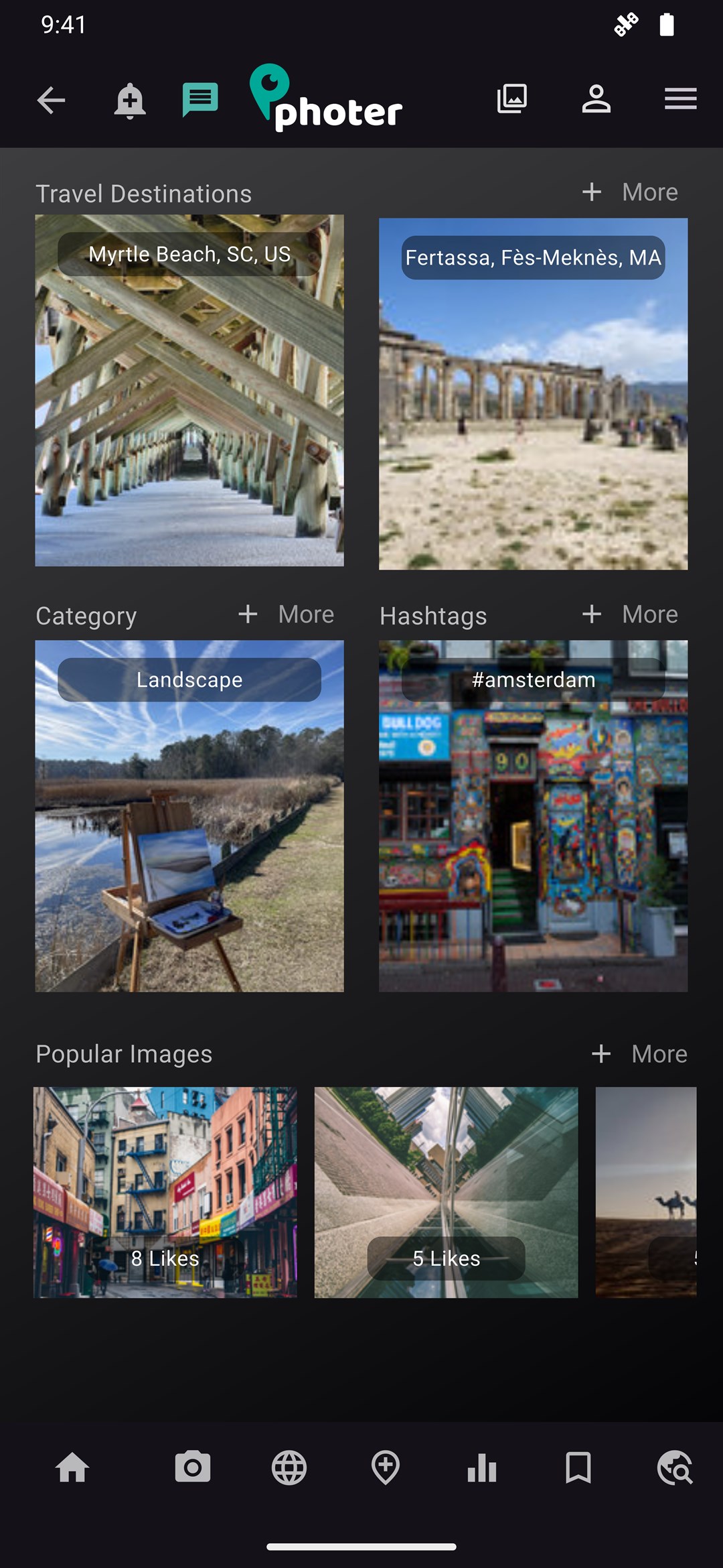
Explore
Destinations, categories, hashtags and popular images in one scroll.
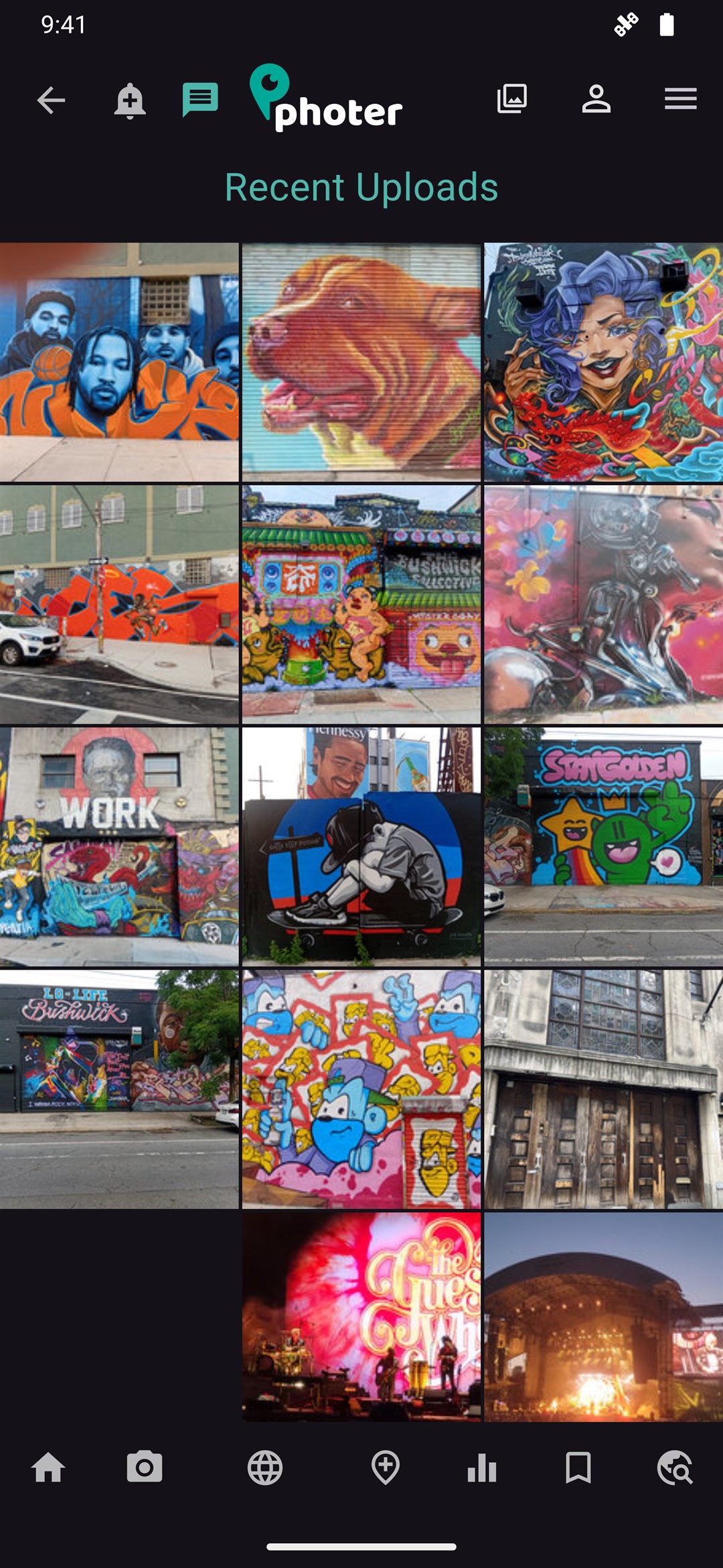
Recent uploads
A live grid of what the community just pinned, anywhere in the world.
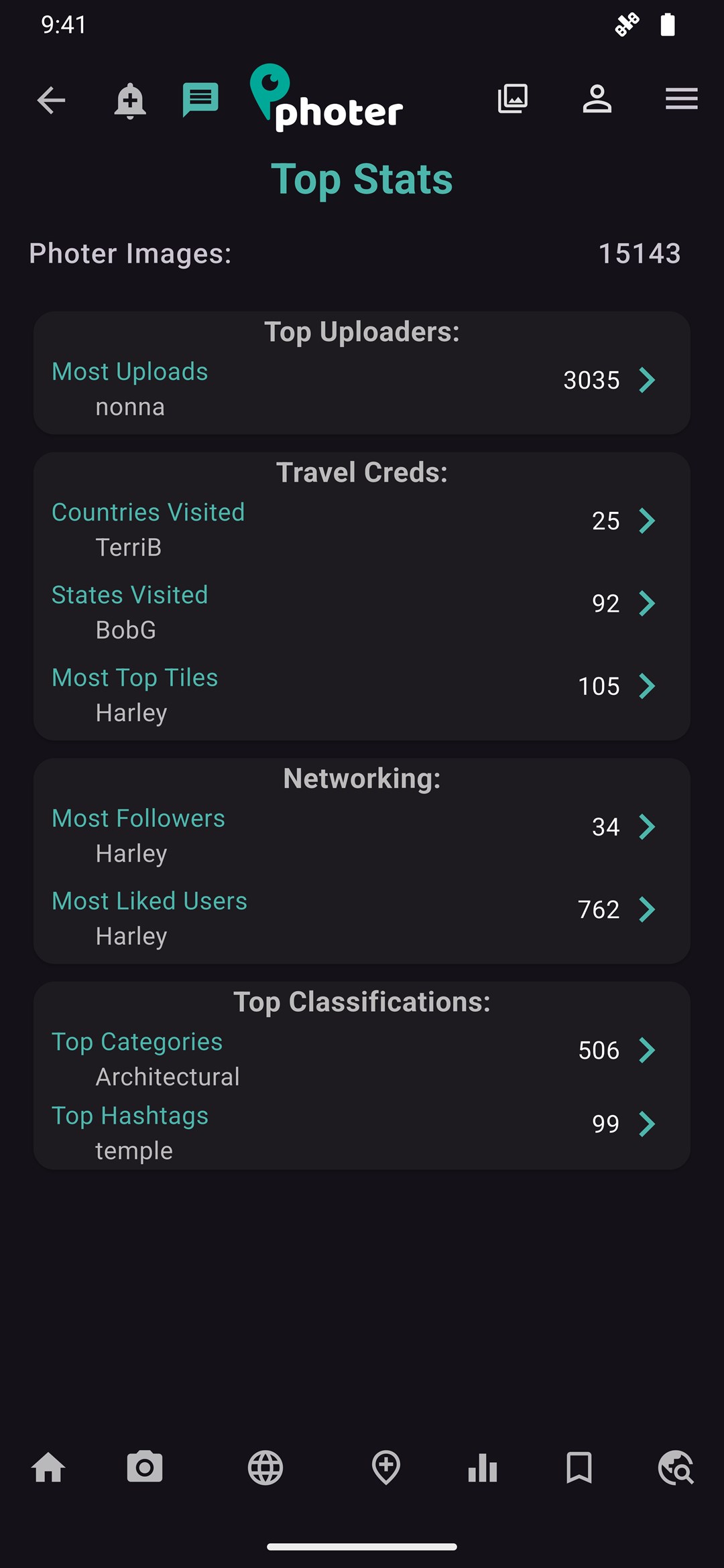
Stats
Top uploaders, countries visited, most-liked users and trending categories.
← Drag to browse more screens →
Where the community is shooting right now.
Pulled straight from the Photer platform — the community's most-liked geo-tagged photos, ranked by likes, exactly as they appear in the app.
From camera roll to world map in three taps.
Shoot or upload
Take a photo in the app or pick one from your gallery. Photer reads the embedded GPS location automatically — no typing required.
Tag & describe
Confirm the pin, pick a category — landscape, food, architecture, sports and more — and add hashtags so locals and travelers can find it.
Explore & get discovered
Your shot joins the global map instantly. Watch the likes come in while you browse everyone else's pins for your next adventure.
A camera roll for the whole planet.
Photer combines a photo community with serious geo-data tooling — simple enough for a weekend trip, powerful enough for location scouting.
Interactive photo map
Pan and zoom a live world map where every photo sits at its true coordinates. Smart grid clusters show photo density per square mile, so hotspots jump out instantly.
Search anything, anywhere
Type an address, a city, or a #hashtag and fly straight there. Filter by distance box — from a 1-mile stroll to a 100-mile road trip radius.
Snap, tag & share
Upload straight from your phone. Photer reads the GPS data automatically, or lets you drop the pin yourself — then adds your shot to the world's shared map.
Likes, follows & trending
Like the shots that stop your scroll, follow photographers whose eye you trust, and watch the Popular feed surface the best new locations each week.
Collections & bookmarks
Save locations into trip plans — a food crawl, a fall-colors route, a photo walk. Your bookmarks live on the map, ready to navigate to when you arrive.
Your stats & footprint
See your personal travel footprint: places pinned, countries reached, likes earned, and your most-loved shots — your photography, quantified.
One map, many kinds of explorers.
Plan trips around real views
Skip the tourist-brochure guesswork. See what a destination actually looks like through hundreds of recent geo-tagged photos, then bookmark your route before you land.
Scout locations like a local
Find the exact vantage point behind that shot — golden-hour piers, murals, overlooks. Check the grid density to find crowded classics or untouched corners.
Get found through photos
When customers pin photos of your restaurant, shop or venue, you show up on the map for every traveler nearby. Real photos from real visitors are the best storefront.


Put your world on the map.
Photer is free to download and free to explore. Your next favorite place is already pinned — and the places only you know about are waiting for their first photo.